All 2026 Bookings FullNow Accepting Commissions for 2027Now Hiring — Contracted Drone VideographersStart the Conversation ↗

    Areas we serve / Coventry Hills

    Drone photography in Coventry Hills, Alberta

    Evening light leaves Coventry Hills from the bottom up — the low ground around Nose Creek Park goes to shadow while the rooflines along Coventry Boulevard NE are still lit.

    Free quote · No obligation · Advanced RPAS certified · Reply within one business day

    Does VeePo Media fly drones in Coventry Hills?

    Yes. VeePo Media flies drone photography and cinematography in Coventry Hills, Alberta. The airspace is Class C control zone (CYYC). A NAV CANADA authorisation is filed before the shoot date is confirmed. Typical mobilisation from the Calgary base is 20 minutes.

    Coventry Hills at a glance.

    Operational facts for aerial work in Coventry Hills, Alberta

    Operational facts for aerial work in Coventry Hills, Alberta

    Base of operations
    Calgary, Alberta
    Drive time from base
    20 minutes
    Airspace
    Class C control zone (CYYC)
    Nearest aerodrome
    Calgary International Airport (CYYC)
    Authorisation required
    Yes — filed before booking is confirmed
    Flight status
    Flown with NAV CANADA authorisation filed
    Certification
    Transport Canada RPAS Pilot Certificate — Advanced Operations
    Response
    Reply within one business day
    Airspace last verified
    2026-09-01

    Flying Coventry Hills: the ground truth.

    Evening light leaves Coventry Hills from the bottom up — the low ground around Nose Creek Park goes to shadow while the rooflines along Coventry Boulevard NE are still lit. Shoot at the wrong hour and the frame splits in two: half warm roofline, half cold shadow, and neither the house nor its setting reads cleanly.

    A golden-hour hold timed to the last even light across the community keeps house and backdrop in the same exposure, delivered in the standard turnaround.

    1. Airspace.

      Coventry Hills sits about 5 km from Calgary International, inside the CYYC control zone as charted. Flights here are conducted under an Advanced RPAS certificate with a NAV CANADA RPAS authorisation obtained before the shoot is confirmed. The specific site and altitude are confirmed against NAV Drone before every flight. This is a corridor-level assessment; the specific address is confirmed against NAV Drone before every flight.

    2. Terrain.

      Rolling north-Calgary ground that falls away eastward to the Nose Creek valley, laid out in looping crescents of family housing.

    3. Wind.

      Chinook belt. West wind arrives over open ground with little to break it, and the Nose Creek valley to the east adds a local channel on strong days.

    4. Light.

      Long summer evenings stretch the golden hour late; in winter the low southern sun means the creek side of the community loses direct light early.

    5. On the ground.

      Drone takeoff and landing in City of Calgary parks and on public pathways is restricted under the parks bylaws, so flights launch from private property with the client's consent. About 20 minutes from the base. An easy same-day booking, and one visit can cover Harvest Hills, Country Hills or Panorama Hills in the same window.

    What is plotted before a Coventry Hills flight.

    These sit inside or immediately adjacent to Coventry Hills and are checked on every sortie. None of them is visible from a map at driveway scale, which is why the address is confirmed against NAV Drone rather than assumed from the postcode.

    • Calgary International Airport (CYYC) approach paths

    Landmarks and communities: Vivo Recreation Centre · Nose Creek Park · Coventry Hills School · Coventry Boulevard NE

    From the reel

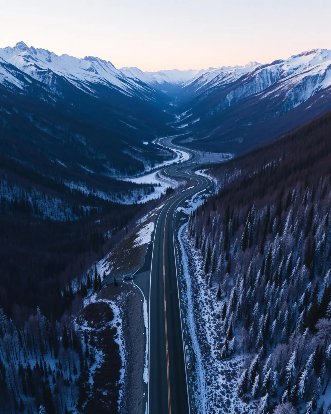
    Aerial looking down a two-lane highway winding through a snow-dusted mountain valley at dusk, forested slopes falling away to snow-capped peaks.
    Aerial looking down a two-lane highway winding through a snow-dusted mountain valley at dusk, forested slopes falling away to snow-capped peaks. — Icefields Parkway · 2025, from the VeePo Media reel. See the full gallery

    What gets shot in Coventry Hills.

    • luxury residential
    • new build subdivision
    • commercial retail

    Every subject above is delivered through the same aerial photography and cinematography services, scoped and quoted before the shoot is booked.

    What the research actually says.

    68% faster

    Listings marketed with aerial photography have been reported to sell substantially faster than those using ground photography alone.

    On a listing carrying monthly holding costs, the weeks removed from time-on-market are the return on the shoot.

    RubyHome, real estate photography research roundup , 2024 · Industry aggregate
    403% more enquiries

    Listings that include video have been reported to receive several times the enquiry volume of listings without it.

    Enquiry volume is the top of the funnel. A listing that starts more conversations closes from a larger pool.

    RubyHome, real estate photography research roundup , 2024 · Industry aggregate

    Advanced certificate

    Transport Canada requires a Pilot Certificate for Advanced Operations to fly a remotely piloted aircraft in controlled airspace or near bystanders.

    Most of Calgary sits inside the CYYC control zone. An operator without this certificate cannot legally fly the majority of addresses in the city.

    Transport Canada , 2025 · Primary source

    Coventry Hills and what surrounds it.

    Relative positions of Coventry Hills and Harvest Hills, Country Hills, Panorama Hills — not a navigational chart. Distances are great-circle approximations from the coordinates on each location page.

    How a Coventry Hills shoot runs.

    1. Scope and quote.

      Most Coventry Hills work is luxury residential or new build subdivision, and the shot list follows the subject. Mobilisation is stated separately from the fee.

    2. Airspace.

      Checked against NAV Drone from the address, not the postcode. Coventry Hills is class c control zone (cyyc), so authorisation is filed before the date is confirmed — but Calgary International Airport (CYYC) is 5 km away and its circuit is plotted regardless.

    3. Weather window.

      Chinook belt. West wind arrives over open ground with little to break it, and the Nose Creek valley to the east adds a local channel on strong days. Long summer evenings stretch the golden hour late; in winter the low southern sun means the creek side of the community loses direct light early.

    4. Shoot day.

      About 20 minutes from the Calgary base. Launch from the subject property with the owner's permission; drone takeoff and landing in City of Calgary parks and on public pathways is restricted under the parks bylaws, so flights launch from private property with the client's consent.

    5. Delivery.

      Edited files delivered digitally — no attendance required at any stage, which is how out-of-province owners of Coventry Hills property are served.

    Coventry Hills questions, answered.

    Do drone flights over Coventry Hills need NAV CANADA approval?

    Yes. Coventry Hills lies about 5 km from Calgary International inside the CYYC Class C control zone, so every flight needs a NAV CANADA RPAS authorisation flown under an Advanced certificate. VeePo Media files that authorisation before confirming your date and verifies the site and altitude in NAV Drone first.

    What time of day photographs Coventry Hills best?

    Late evening in summer. The community slopes toward Nose Creek Park, and the low ground goes to shadow before the rooftops do, so the last even light is the window that holds both. We schedule Coventry Hills shoots against that light rather than against a clock time.

    What has to be checked before a drone flight in Coventry Hills?

    Calgary International Airport (CYYC) approach paths. Each sits inside or immediately adjacent to Coventry Hills and is plotted before every sortie. Coventry Hills sits about 5 km from Calgary International, inside the CYYC control zone as charted. Flights here are conducted under an Advanced RPAS certificate with a NAV CANADA RPAS authorisation obtained before the shoot is confirmed. The specific site and altitude are confirmed against NAV Drone before every flight.

    How quickly can a drone shoot happen in Coventry Hills?

    Mobilisation from the Calgary base is 20 minutes. The binding constraint is the NAV CANADA authorisation, which is filed before the date is confirmed rather than after. Reply within one business day on any enquiry.

    The rules that govern a Coventry Hills flight

    Coventry Hills flight quote

    Tell me where, andwhat it needs to show.

    Free quote · No obligation · Advanced RPAS certified · Reply within one business day