All 2026 Bookings FullNow Accepting Commissions for 2027Now Hiring — Contracted Drone VideographersStart the Conversation ↗

    Areas we serve / Keoma

    Drone photography in Keoma, Alberta

    Keoma's airspace record is short on purpose: Class G overhead, the nearest aerodrome about 20 km away at Strathmore, and no control zone charted over the hamlet. The regulatory geometry that shapes flights closer to the city runs out before it reaches Keoma Crossroads.

    Free quote · No obligation · Advanced RPAS certified · Reply within one business day

    Does VeePo Media fly drones in Keoma?

    Yes. VeePo Media flies drone photography and cinematography in Keoma, Alberta. The airspace is Class G uncontrolled. Authorisation is not normally required in this airspace. Typical mobilisation from the Calgary base is 40 minutes.

    Keoma at a glance.

    Operational facts for aerial work in Keoma, Alberta

    Operational facts for aerial work in Keoma, Alberta

    Base of operations
    Calgary, Alberta
    Drive time from base
    40 minutes
    Airspace
    Class G uncontrolled
    Nearest aerodrome
    Strathmore aerodrome
    Authorisation required
    No
    Flight status
    Flown routinely
    Certification
    Transport Canada RPAS Pilot Certificate — Advanced Operations
    Response
    Reply within one business day
    Airspace last verified
    2026-09-01

    Flying Keoma: the ground truth.

    Keoma's airspace record is short on purpose: Class G overhead, the nearest aerodrome about 20 km away at Strathmore, and no control zone charted over the hamlet. The regulatory geometry that shapes flights closer to the city runs out before it reaches Keoma Crossroads. Clients often assume every shoot near Calgary carries airport paperwork and lead time, so they book late and pad the schedule. Here that assumption costs them the good weather window, because the actual constraints at Keoma are wind and light, not authorisation.

    Booking is planned against the forecast instead of the paperwork — a golden-hour hold or a short-notice flight is realistic at Keoma, confirmed against NAV Drone as the final check and delivered in the standard turnaround.

    1. Airspace.

      Keoma lies outside the charted Calgary-area control zones in uncontrolled Class G airspace, about 20 km from Strathmore aerodrome. No airspace authorisation is normally required. The specific site and altitude are confirmed against NAV Drone before every flight. This is a corridor-level assessment; the specific address is confirmed against NAV Drone before every flight.

    2. Terrain.

      Level to gently rolling grain country divided by the range-road grid; from altitude Keoma reads as a crossroads settlement with fields running unbroken to the horizon on every side.

    3. Wind.

      Chinook-belt prairie with open exposure in every direction. West wind crosses the corridor unimpeded, and afternoons typically run windier than mornings as daytime heating builds, so calm-light windows sit at either end of the day.

    4. Light.

      The crop cycle is the palette. Seeded rows, green-up, swathing and stubble each give the grid around Keoma Crossroads a different texture, and low sun at either end of the day rakes that texture into relief. Snow turns the same grid graphic and simple.

    5. On the ground.

      Municipal ground at Keoma falls under Rocky View County's park and public-land rules, so takeoff and landing are staged from the subject property with the owner's consent. About 40 minutes from the Calgary base. With no paperwork lead time, short-notice work is realistic, and Kathyrn, Dalroy and Delacour sit close enough to share the mobilisation.

    Landmarks and communities: Keoma Crossroads · Keoma Community Grounds · Highway 566 · Keoma Road · Range Road 275

    From the reel

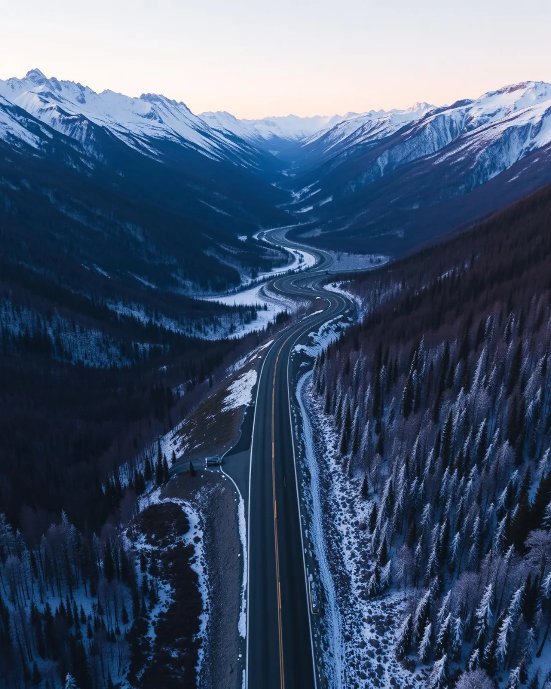
    Aerial looking down a two-lane highway winding through a snow-dusted mountain valley at dusk, forested slopes falling away to snow-capped peaks.
    Aerial looking down a two-lane highway winding through a snow-dusted mountain valley at dusk, forested slopes falling away to snow-capped peaks. — Icefields Parkway · 2025, from the VeePo Media reel. See the full gallery

    What gets shot in Keoma.

    • agricultural
    • industrial yard

    Every subject above is delivered through the same aerial photography and cinematography services, scoped and quoted before the shoot is booked.

    What the research actually says.

    30% more

    McKinsey research cited across the inspection sector finds that organisations relying on manual inspection spend materially more on maintenance and safety than those using drone-based assessment.

    For a portfolio of assets, the inspection method is a recurring cost line, not a one-off purchase. The differential compounds annually.

    McKinsey & Company, cited by Averroes , 2025 · Industry aggregate
    Up to 75% less time

    McKinsey & Company reports that drones can cut surveying time by up to three quarters against traditional ground methods — a three-day site survey completed inside one.

    On a consulting engagement billed by the day, survey duration is not a line item. It is the schedule.

    McKinsey & Company, cited by Datumate , 2025 · Industry aggregate

    Advanced certificate

    Transport Canada requires a Pilot Certificate for Advanced Operations to fly a remotely piloted aircraft in controlled airspace or near bystanders.

    Most of Calgary sits inside the CYYC control zone. An operator without this certificate cannot legally fly the majority of addresses in the city.

    Transport Canada , 2025 · Primary source

    Keoma and what surrounds it.

    Relative positions of Keoma and Kathyrn, Dalroy, Delacour — not a navigational chart. Distances are great-circle approximations from the coordinates on each location page.

    How a Keoma shoot runs.

    1. Scope and quote.

      Most Keoma work is agricultural or industrial yard, and the shot list follows the subject. Mobilisation is stated separately from the fee.

    2. Airspace.

      Checked against NAV Drone from the address, not the postcode. Keoma is class g uncontrolled, so authorisation is not normally required — but Strathmore aerodrome is 20 km away and its circuit is plotted regardless.

    3. Weather window.

      Chinook-belt prairie with open exposure in every direction. West wind crosses the corridor unimpeded, and afternoons typically run windier than mornings as daytime heating builds, so calm-light windows sit at either end of the day. The crop cycle is the palette. Seeded rows, green-up, swathing and stubble each give the grid around Keoma Crossroads a different texture, and low sun at either end of the day rakes that texture into relief. Snow turns the same grid graphic and simple.

    4. Shoot day.

      About 40 minutes from the Calgary base. Launch from the subject property with the owner's permission; municipal ground at Keoma falls under Rocky View County's park and public-land rules, so takeoff and landing are staged from the subject property with the owner's consent.

    5. Delivery.

      Edited files delivered digitally — no attendance required at any stage, which is how out-of-province owners of Keoma property are served.

    Keoma questions, answered.

    How does airspace affect booking a drone shoot in Keoma?

    It barely does. Keoma lies in uncontrolled Class G airspace about 20 km from Strathmore aerodrome, outside the charted Calgary-area control zones, so no authorisation is normally required and no paperwork lead time applies. The site and altitude are still confirmed against NAV Drone before every flight.

    What is worth photographing from the air around Keoma?

    Working agricultural land, first and foremost. Yard sites, field pattern and the crossroads settlement itself all read strongly from altitude, and Highway 566 gives equipment and yard operations a natural approach-run subject. The strongest material follows the crop cycle rather than any fixed calendar date.

    Can Keoma be shot on the same trip as neighbouring hamlets?

    Yes. Keoma is about 40 minutes from the Calgary base, and Kathyrn, Dalroy and Delacour all sit within a short drive, so one mobilisation can cover several properties across the corridor. Grouping shoots this way is the most efficient booking for this part of Rocky View County.

    How quickly can a drone shoot happen in Keoma?

    Mobilisation from the Calgary base is 40 minutes. Authorisation is not normally required here, so the binding constraint is the weather window rather than paperwork. Reply within one business day on any enquiry.

    The rules that govern a Keoma flight

    Keoma flight quote

    Tell me where, andwhat it needs to show.

    Free quote · No obligation · Advanced RPAS certified · Reply within one business day