All 2026 Bookings FullNow Accepting Commissions for 2027Now Hiring — Contracted Drone VideographersStart the Conversation ↗

    Areas we serve / Balzac

    Drone photography in Balzac, Alberta

    From the air, Balzac's calendar lives in its fields. CrossIron Mills reads the same in midwinter as in midsummer, while the cropland around the Rocky View County Balzac Commercial Corridor runs its whole cycle — bare soil, green-up, swathed rows, stubble under snow.

    Free quote · No obligation · Advanced RPAS certified · Reply within one business day

    Does VeePo Media fly drones in Balzac?

    Yes. VeePo Media flies drone photography and cinematography in Balzac, Alberta. The airspace is Class C control zone (CYYC). A NAV CANADA authorisation is filed before the shoot date is confirmed. Typical mobilisation from the Calgary base is 25 minutes.

    Balzac at a glance.

    Operational facts for aerial work in Balzac, Alberta

    Operational facts for aerial work in Balzac, Alberta

    Base of operations
    Calgary, Alberta
    Drive time from base
    25 minutes
    Airspace
    Class C control zone (CYYC)
    Nearest aerodrome
    Calgary International Airport (CYYC)
    Authorisation required
    Yes — filed before booking is confirmed
    Flight status
    Flown with NAV CANADA authorisation filed
    Certification
    Transport Canada RPAS Pilot Certificate — Advanced Operations
    Response
    Reply within one business day
    Airspace last verified
    2026-09-01

    Flying Balzac: the ground truth.

    From the air, Balzac's calendar lives in its fields. CrossIron Mills reads the same in midwinter as in midsummer, while the cropland around the Rocky View County Balzac Commercial Corridor runs its whole cycle — bare soil, green-up, swathed rows, stubble under snow. Whatever the fields are doing on shoot day becomes the frame. A leasing or marketing shoot planned from a calendar can put a commercial site against bare black soil when the client imagined green, and from the road that backdrop is invisible until the aircraft is up.

    The date is set against the state of the ground, not the month. VeePo Media holds the booking for the window when the surrounding land carries the colour the material needs, files the CYYC authorisation as part of booking, and flies the approach run in the standard turnaround.

    1. Airspace.

      Balzac sits about 9 km from Calgary International, inside the CYYC control zone as charted. Flights here are conducted under an Advanced RPAS certificate with a NAV CANADA RPAS authorisation obtained before the shoot is confirmed. Before any flight, the exact site and altitude are checked against NAV Drone. This is a corridor-level assessment; the specific address is confirmed against NAV Drone before every flight.

    2. Terrain.

      Flat cropland at Calgary's north edge, interrupted by the roofs and parking fields of the commercial corridor; from altitude the retail development reads as an island set into working quarter-sections.

    3. Wind.

      Chinook belt, wide open. Nothing between the foothills and these fields slows a west wind, and the corridor's large flat roofs add mechanical turbulence close to the buildings, so approach lines are planned upwind.

    4. Light.

      Green-up and harvest carry the frame — the corridor's buildings are constant while the surrounding fields supply the colour and the pattern. Snow inverts the picture, turning the dark roofs into the graphic element against white ground.

    5. On the ground.

      Rocky View County's rules govern takeoff and landing on municipal land, and the corridor's commercial parcels are private property — launches are staged from the client's own site with permission. About 25 minutes from the Calgary base, close enough for same-day work once the CYYC authorisation is in hand. A Balzac visit pairs naturally with Dalroy, Delacour or Kathyrn on a single trip.

    What is plotted before a Balzac flight.

    These sit inside or immediately adjacent to Balzac and are checked on every sortie. None of them is visible from a map at driveway scale, which is why the address is confirmed against NAV Drone rather than assumed from the postcode.

    • Calgary International Airport (CYYC) approach paths

    Landmarks and communities: CrossIron Mills · Balzac Farmers' Market · Rocky View County Balzac Commercial Corridor · Balzac Road · Range Road 292

    From the reel

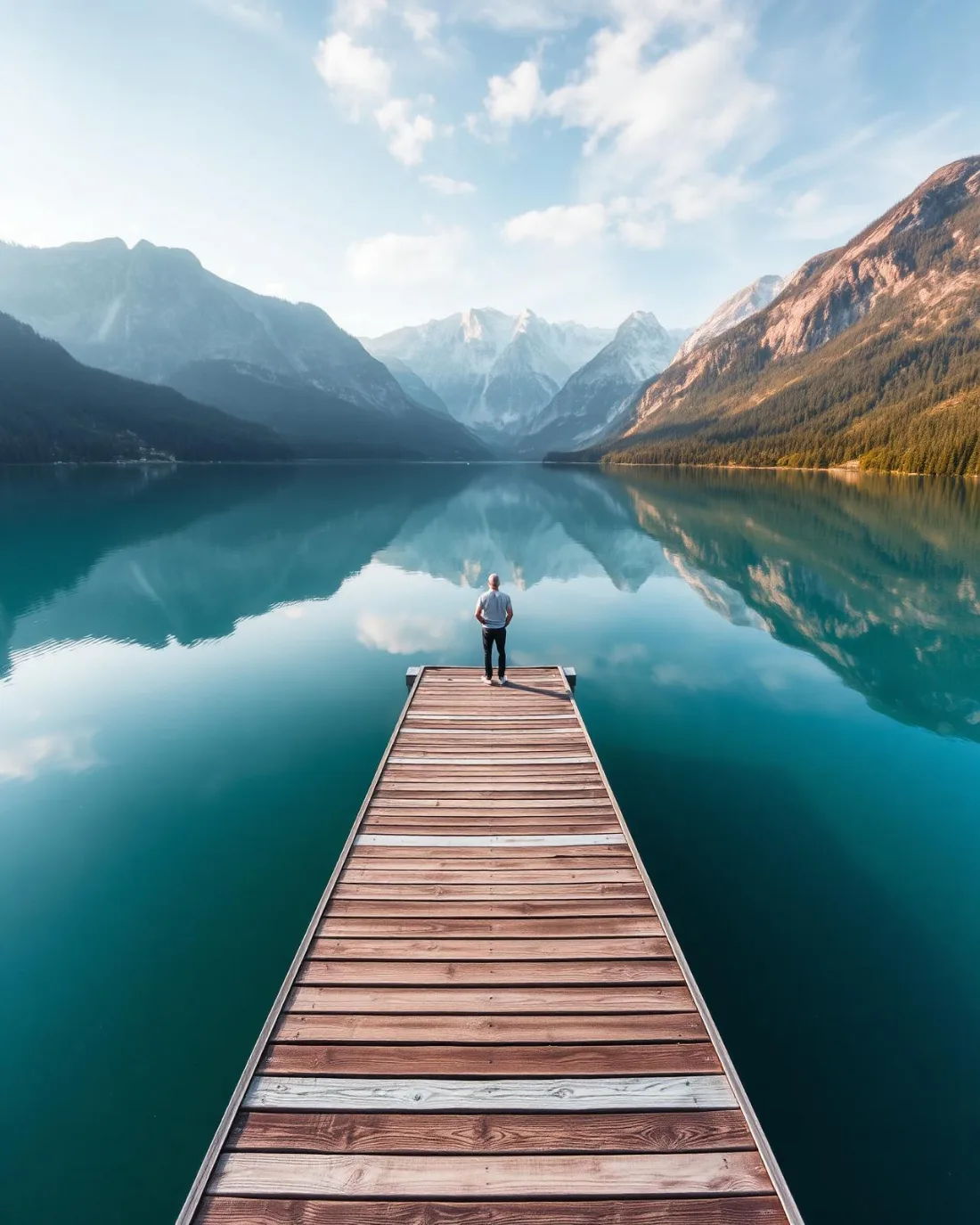
    Person standing on a wooden dock at a still alpine lake.
    Person standing on a wooden dock at a still alpine lake. — Lake Minnewanka · 2024, from the VeePo Media reel. See the full gallery

    What gets shot in Balzac.

    • commercial retail
    • industrial yard
    • agricultural

    Every subject above is delivered through the same aerial photography and cinematography services, scoped and quoted before the shoot is booked.

    What the research actually says.

    Industry standard

    The National Association of Realtors maintains dedicated guidance on commercial drone use in listing marketing, including the certification and airspace rules an operator must meet.

    Aerial media is an established part of listing marketing with real compliance requirements. The question is whether your operator meets them, not whether to use it.

    National Association of Realtors , 2025 · Primary source
    30% more

    McKinsey research cited across the inspection sector finds that organisations relying on manual inspection spend materially more on maintenance and safety than those using drone-based assessment.

    For a portfolio of assets, the inspection method is a recurring cost line, not a one-off purchase. The differential compounds annually.

    McKinsey & Company, cited by Averroes , 2025 · Industry aggregate

    Advanced certificate

    Transport Canada requires a Pilot Certificate for Advanced Operations to fly a remotely piloted aircraft in controlled airspace or near bystanders.

    Most of Calgary sits inside the CYYC control zone. An operator without this certificate cannot legally fly the majority of addresses in the city.

    Transport Canada , 2025 · Primary source

    Balzac and what surrounds it.

    Relative positions of Balzac and Dalroy, Keoma, Kathyrn — not a navigational chart. Distances are great-circle approximations from the coordinates on each location page.

    How a Balzac shoot runs.

    1. Scope and quote.

      Most Balzac work is commercial retail or industrial yard, and the shot list follows the subject. Mobilisation is stated separately from the fee.

    2. Airspace.

      Checked against NAV Drone from the address, not the postcode. Balzac is class c control zone (cyyc), so authorisation is filed before the date is confirmed — but Calgary International Airport (CYYC) is 9 km away and its circuit is plotted regardless.

    3. Weather window.

      Chinook belt, wide open. Nothing between the foothills and these fields slows a west wind, and the corridor's large flat roofs add mechanical turbulence close to the buildings, so approach lines are planned upwind. Green-up and harvest carry the frame — the corridor's buildings are constant while the surrounding fields supply the colour and the pattern. Snow inverts the picture, turning the dark roofs into the graphic element against white ground.

    4. Shoot day.

      About 25 minutes from the Calgary base. Launch from the subject property with the owner's permission; rocky View County's rules govern takeoff and landing on municipal land, and the corridor's commercial parcels are private property — launches are staged from the client's own site with permission.

    5. Delivery.

      Edited files delivered digitally — no attendance required at any stage, which is how out-of-province owners of Balzac property are served.

    Balzac questions, answered.

    Is Balzac inside Calgary's controlled airspace?

    Yes. Balzac sits about 9 km from Calgary International, inside the CYYC Class C control zone as charted. Flights are conducted under an Advanced RPAS certificate with a NAV CANADA authorisation obtained before the shoot date is confirmed, and the specific site and altitude are checked against NAV Drone before every flight.

    Can you photograph commercial property around CrossIron Mills?

    Yes. The commercial corridor is the main reason clients book Balzac. Because the area sits inside the CYYC control zone, the authorisation is filed as part of booking rather than added afterwards, and the flight plan is built around the approved altitude for the specific site.

    When is the best season for an aerial shoot in Balzac?

    It depends on the backdrop the material needs. The corridor's buildings look the same year-round from altitude; the surrounding cropland does not. Green-up gives the strongest colour, harvest gives pattern and texture, and snow simplifies everything. The booking is timed to the state of the fields, not the month.

    What has to be checked before a drone flight in Balzac?

    Calgary International Airport (CYYC) approach paths. Each sits inside or immediately adjacent to Balzac and is plotted before every sortie. Balzac sits about 9 km from Calgary International, inside the CYYC control zone as charted. Flights here are conducted under an Advanced RPAS certificate with a NAV CANADA RPAS authorisation obtained before the shoot is confirmed. Before any flight, the exact site and altitude are checked against NAV Drone.

    How quickly can a drone shoot happen in Balzac?

    Mobilisation from the Calgary base is 25 minutes. The binding constraint is the NAV CANADA authorisation, which is filed before the date is confirmed rather than after. Reply within one business day on any enquiry.

    The rules that govern a Balzac flight

    Balzac flight quote

    Tell me where, andwhat it needs to show.

    Free quote · No obligation · Advanced RPAS certified · Reply within one business day